Taiwan National Coalition Against the Hushan Dam
The following is an excerpt from "Who wrung the river dry?", a book by Li Gen-jheng, director of the Ecological Education Center in Kaohsiung, Taiwan, about the geological, ecological, social and legal controversies surrounding The Hushan Dam Project.
Acknowledgments
In Taiwan, it is not only secret documents relating to state security that are hard to obtain; much information that should be freely available is not. This leads to serious differences between the information held by government, engineering consultants and academia.
Nevertheless, this book tries to offer objective information based on what evidence we do possess, for the purpose of establishing a basis for dialogue and public supervision.
I would like to express my thanks to Sam Lin (林聖崇Lin Sheng-chong), a veteran of Taiwan’s environmental movement, for inspiring the argument for comprehensive information on the September 1999 earthquake, the collapse of Tsao-ling Pond, and coastal subsidence, and also to Yunlin Wild Bird Society for information on frogs and birds such as the Fairy Pitta, as well as to Professor Yang Kuo-jhen of Providence University for his professional support in the subjects of plant ecology and geography.
For the last three years Miss Lin Dai-ching and I have devoted ourselves to compiling information and doing follow-up work on the issues of social equality and water resources, and we continue to write up our findings.
This book has been produced with limited human and material resources. We welcome any comments and criticism.
Foreword
Jhushan and Douliou, set in Nantou and Yunlin Counties, were two relatively low-key towns, until the news broke that a reservoir was to be built nearby…
Hushan development project
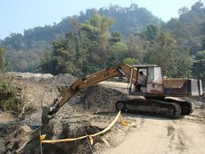
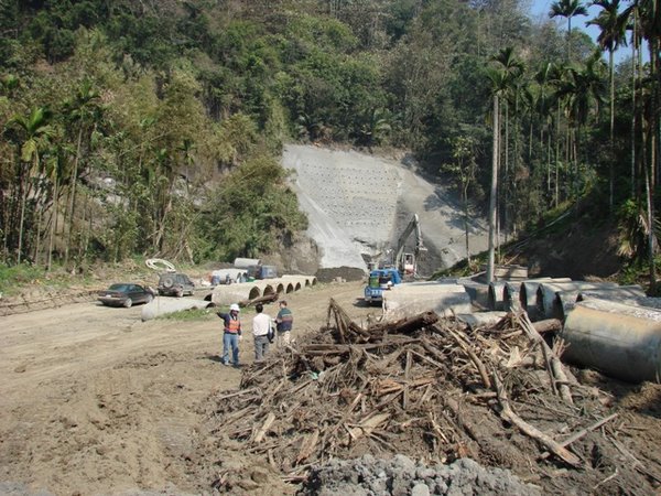
A feasibility plan for the Hushan Dam was carried out in 1994-5. In May 2000, the EPA reviewed and approved the Environmental Impact Assessment (EIA), and in January 2001, the Executive Yuan gave the project the go-ahead, with a 7 year time limit for implementation, and a budget of NTD162 billion. The first phase of construction of the connecting road is already underway. But up to now, many people remain uninformed about the project, and in some cases have even been maliciously lied to.
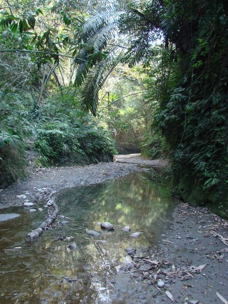
Hushan is planned as an off-stream reservoir. Water from the Cingsheui River is diverted using a weir, located in Jhu-shan Town, Nantou County, and channeled over a distance of 6.9 km to the main dam, situated in the vicinity of You-cing Valley and Lunbei Pit, about 10 km south-east of Douliu City. The project area is about 422 hectares, 228 hectares of which are situated within protected Forestry Bureau plots 71-73 in the Alishan Area, and are precious areas of water conservation. These parts will be flooded if the dam is constructed.
The government says that the Hushan reservoir alone will be able to supply 248 thousand tons of water a day, and if used in parallel with the Jiji weir, it will supply 694 thousand tons of water a day.
In 2002, some residents of Douliu examined the reservoir project and found it to be riddled with problems. They initiated the protest movement and were soon joined by environmental groups, and also by residents of Jhu-shan protesting against the Tong-tou weir. Over the last three years, these groups have given countless testimonies before policy-makers showing the ridiculousness and inappropriateness of the project. But the government still obstinately refuses to face facts. So we at the Ecological Education Center decided to set out our reasons and evidence, item by item, and allow the public and the course of history to pass judgment.
But Taiwan is almost out of water – what are we protesting about?
If you find yourself asking such a question, please spend a little time reading this book. After reading, we sincerely hope you can join with us in linking hands in an effort to protect our homeland.
Part 1: Senseless! A reservoir that would collapse and leak as if it were made of sugar cubes.
Hushan reservoir is in the upper region of greater Douliu. Should it collapse, real estate in the Greater Douliu area will be destroyed in a matter of seconds, the whole place being swamped. The force with which it would wash down will be like a 150 ton truck traveling at 250 km/h.
Who can guarantee that there won’t be another Jiji earthquake?
Within 50 km of the Hushan dam site are the Dajian Mountain, Mei Mountain, Chukou, Chelongpu, Dajia and Mujicha active faults (Hsin-de Company, MOEA Water Resources Agency Water Planning Department). In the planned site of the Hushan dam, the control fault is Meishan, and the largest earthquake that could potentially occur would be of magnitude 7.1, which is the largest earthquake to have occurred near the dam. In the magnitude 7.3 Jiji earthquake of 21 September 1999, the Chelongpu fault moved again. According to the Central Geological Survey (MOEA), the closest part of the fault to the Hunan Dam (the southern section of the Hushan dam project) is only 5-6 km away (MOEA Water Resources Agency, Water Planning Department). Also, the southernmost point of this fault passes directly through the site of the Hushan Reservoir’s weir site (Tong-tou) in a north-easterly direction, meaning that fault movement would cause the Tong-tou Bridge downstream from the weir to completely collapse. The cross-border channel also passes through this fault area (MOEA Water Resources Bureau 1999).
In Addition, to the west side of the main dam it has been discovered that there is a highly active fault, Tongshu Lake Fault, situated below the reservoir, only 1.8 km away from the main dam (Water Planning Center 2002). It still remains to be researched whether, if this fault were to move a second time, the back thrust or branching faults it would produce would pass through the dam.
So we have the Hushan reservoir being squeezed from east and west by these two highly active faults, Chelongpu and Tongshuhu faults. However these two important faults were not mentioned at all in the EIA.
The great Jiji earthquake forced the abandonment of construction of the 166m high, 131 million cubic meter Rui-feng Reservoir. But the plan for the Hushan Dam, planned for construction in the same earthquake zone, is still being carried out according to the original proposal.
An unsafe reservoir
After the Jiji earthquake, research showed that the possible impact of the Dajian Mountain and Tongshu Lake faults are much greater than allowed for in the original Hushan dam plans.
* Dajian Mountain fault is seen as being the same fault as the Northern Chelongpu fault, length 87.5 km, and is an extremely new and active reverse fault. (Nov. 2000: Earthquake Research and EIAs for Hushan and Hunan reservoirs, Yunlin).
* Qiulu area in Douliu and the hills to its east are under stress in an ESE to WNW direction, and Dajian Mountain fault (Chelongpu fault or Chukou Fault), Tongshuhu fault, Jiuqiongkang fault and Mei Mountain fault are all faults caused by this structural stress in the earth. Among these, Dajian Mountain fault and Mei Mountain fault have both been active recently, therefore the future possibility of activity along Tongshu Lake fault, which also belongs to this stress system, is self-evident. (June 2002: Follow-up on Caoling Weir Saihu Fault and special research report on earthquake survey assessment).
* At present there are no signs that show that Tongshu Lake fault will move again, causing back thrust or branch faults passing through the dam site. But in order to establish the level of safety, further investigations and analysis should be carried out; the design of the Hushan dam and the detailed research of impact of Tongshu Lake fault should happen simultaneously, and renewed adjustments to the reservoir plan should be made after the completion of the new research (June 2002, Follow-up of Caoling weir Saihu Fault and special research report on earthquake survey assessment).
* In the 2000 EIA for the Hushan dam, it was calculated from past movement of the Mei Mountain fault (magnitude 7.1) that the maximum ground surface acceleration of Hushan Dam would be 0.3g, meaning that an earthquake would not affect the reservoir. However, if calculated taking the Chelongpu Fault (recorded magnitude 7.3) as the control fault, the maximum land surface acceleration is raised to 0.45g; or taking Tongshu Lake as the control fault, it would be an even higher 0.56g; both far exceeding the impact originally planned for (compiled from June 2002 Follow-up of Caoling Weir Saihu Fault and special research report on earthquake survey assessment).
Before the Chelongpu fault moved, causing the Jiji earthquake, who could have known that this was an active fault? And who could have predicted the disaster it caused? However, in their EIA, the developers convey the optimistic belief that modern engineering is all that is necessary to compete with unpredictable earthquakes, even suggesting that “If the dam should collapse, the flooded area includes Sianzihkeng, Sizihdi, SinSi, Meilin and Beizitou Farms, a total area of 325.87 hectares, while the losses in a disaster would be only NTD 41,770,500”. There was absolutely no calculation of the cost of human lives.
It was also claimed that, even if the dam were to break, the floodwater would leak in to the Beitou area, and follow the natural water route into Beigang River and into the sea, causing no effect to Douliu City, which is on higher land.
We merely ask, who can guarantee that when it collapses, the water will obediently channel into Beigang River?
More research is needed at this stage. The water resources authorities should confront these problems, rather than brushing them aside with the argument that “with current engineering technology we should be able to overcome it.”
Translated and edited by Christina MacFarquhar
Saturday, May 5, 2007
Who Wrung the River Dry?
![]()
Subscribe to:
Post Comments (Atom)


No comments:
Post a Comment